The short answer: Critical incident mapping is a GIS-powered system that delivers verified, gridded facility maps to first responders during emergencies. It combines high-resolution aerial imagery, verified floor plans, alphanumeric grid overlays, and real-time data layers, typically made accessible to 911 centers and mobile CAD systems. Top performers focus on spatial accuracy, dispatch integration, and compliance with state mandates.
When a 911 call comes in, responders face a brutal truth: they're navigating unfamiliar buildings under pressure with incomplete information. Traditional floor plans fail at the worst moments. They show walls and doors, but not elevation changes, locked stairwells, or the fastest route to a victim's location. Critical incident mapping solves this by delivering spatially accurate, digitally accessible maps that integrate directly with public safety platforms.
This isn't theoretical. As of 2026, 16 U.S. states have passed legislation requiring or funding school safety mapping programs, with five mandating it and eleven funding it through grants. More than 20 states have enacted or proposed digital school mapping measures in the past few years, according to an Associated Press analysis aided by the bill-tracking software Plural. The shift from paper plans to spatial intelligence is accelerating, driven by mandate, liability, and operational necessity.
This guide breaks down what critical incident mapping actually is, how it works technically, what compliance frameworks demand, and how organizations implement systems that hold up under crisis conditions.
What Is Critical Incident Mapping, and Why Do Traditional Floor Plans Fail?
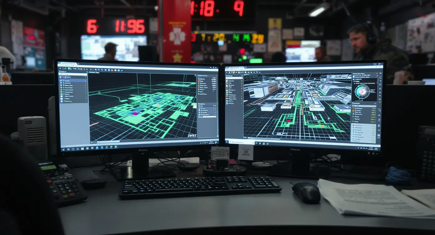
Critical incident mapping represents a fundamental upgrade from static blueprints to responsive, spatially intelligent facility representations. The core difference: traditional floor plans are architectural documents created for construction, not crisis response. They lack grid references, real-time updates, and the spatial context responders need to handle under stress.
The Anatomy of a Critical Incident Map
A complete critical incident mapping system layers multiple data sources into a single, actionable view. The foundation starts with high-resolution aerial or satellite imagery showing the facility's exterior context, surrounding terrain, and access points. This gets paired with verified interior floor plans that have been field-validated, not pulled from decades-old permit files.
The spatial intelligence layer adds alphanumeric grid overlays, similar to a street map grid, so dispatchers and responders can communicate precise locations without ambiguity. Room numbers, suite designations, stairwell locations, utility shutoffs, AED placements, and emergency exits are labeled and geocoded. Category-leading deployments are designed to integrate with Next Generation 911 (NG9-1-1) infrastructure, Computer-Aided Dispatch (CAD) platforms, and mobile applications that responders carry in the field.
A recurring finding across mapping programs is that archived blueprints are rarely reliable. When facilities pull permit-era floor plans to digitize them for emergency use, they routinely discover the documents are outdated, missing renovations, or physically inaccurate. That is why field verification, not document retrieval, is the foundation of a usable critical incident map.
Why Paper Plans and PDFs Don't Work in Crisis
Paper floor plans and static PDFs fail for three operational reasons. First, they can't show real-time conditions or integrate with live sensor data. A PDF won't tell you which door is locked, where smoke detectors have triggered, or which stairwell is blocked. Second, they lack spatial coordinates that CAD systems and GPS-enabled devices can consume. A responder can't route to "Room 214" if the system doesn't know where Room 214 exists in physical space.
Third, paper plans don't scale across jurisdictions. A school district with 40 buildings can't push updated PDFs to every fire department, police agency, and EMS provider with jurisdiction. Critical incident mapping platforms solve this by hosting maps in cloud-accessible formats that update once and propagate everywhere, meeting the interoperability requirements that a growing number of states now write into law.
| Factor | What it is | Impact |
|---|---|---|
| Spatial accuracy | Verified coordinates for every room, asset, and access point | High |
| Grid overlay | Alphanumeric reference system for precise location communication | High |
| CAD integration | Direct feed into dispatch and mobile responder systems | High |
| Update workflow | Process to keep maps current as facilities change | Medium |
| Multi-agency access | Shared visibility across police, fire, EMS, and dispatch | High |
How Does Critical Incident Mapping Integrate with Public Safety Infrastructure?
The technical architecture of critical incident mapping determines whether it's useful in theory or actionable in practice. Integration with existing public safety platforms isn't optional, it's the entire value proposition. A beautiful map that lives in a proprietary app responders don't use is worthless.
NG9-1-1 and CAD Platform Integration
Next Generation 911 infrastructure represents the backbone of modern emergency dispatch. NG9-1-1 systems handle digital data, not just voice calls, which means they can consume and display spatial data from critical incident mapping platforms. When a 911 call originates from a school, hospital, or corporate campus with mapped data, the dispatcher sees the caller's location overlaid on a gridded facility map, not just a street address.
Some mapping platforms are designed to feed that data to Computer-Aided Dispatch systems, which can route responding units to the facility. The critical incident mapping layer feeds CAD with geocoded room numbers, stairwell locations, and hazard markers. Wisconsin Act 109 requires grant-funded critical incident mapping data to be compatible with public safety platforms, require no additional software purchase, and include building numbers, floors, suite designations, and room numbers.
Texas reaches the same outcome from a different angle. Texas House Bill 3, enacted in 2023, requires school districts to provide an accurate map of each campus and building to first responders, developed to the standards set in the Texas Education Code (Texas School Safety Center, 2023). Across states, these mandates push vendors toward open, interoperable systems rather than proprietary walled gardens, because a map first responders cannot open in their own software is worthless.
Mobile Access and Field-Level Usability
Responders don't work through from a desktop terminal. They need maps on tablets and smartphones while moving through smoke-filled hallways or coordinating perimeter positions. Critical incident mapping platforms push data to mobile CAD apps, giving officers and firefighters the same gridded view dispatch sees, updated in real time as conditions change.
The mobile interface must be simple enough to parse under stress. A responder arriving at a multi-building campus needs to identify which structure matches the incident, locate the correct entrance, and manage to the reported room, all within seconds. Grid overlays solve this by giving every zone a coordinate (e.g., "B-4, Room 214") that's consistent across dispatch radio, mobile screens, and printed quick-reference cards.
Field-level usability also means offline access. Network connectivity fails in basements, rural areas, and during infrastructure damage. The best critical incident mapping systems cache map data locally on mobile devices so responders retain navigation capability even when cellular and Wi-Fi drop.
Which States Mandate Critical Incident Mapping?
Critical incident mapping has moved from optional best practice to legal requirement in a growing number of states. The legislative push accelerated after high-profile school incidents exposed gaps in responder situational awareness, and it's expanding beyond K-12 into higher education, healthcare, and public facilities.
The Alyssa's Law and Mapping Mandate Distinction
Buyers often confuse two separate legislative tracks. Alyssa's Law, named after Parkland victim Alyssa Alhadeff, focuses on panic buttons and silent alarm systems that alert law enforcement to active threats. That's a notification and alert capability, not a mapping requirement. Critical incident mapping mandates are distinct: they require facilities to provide accurate, digitally accessible floor plans and site maps to first responders before an incident occurs.
States like Florida, Illinois, Texas, and Michigan have passed legislation making school mapping a mandatory part of their security programs, according to Security Info Watch. The statutory language across these states is consistent: facilities must submit current, digitally accessible mapping data for each building to the law enforcement agencies with jurisdiction, in formats those agencies can open without buying additional software.
The momentum is recent and still building, which is why compliance behaves more like a moving target than a one-time deadline. Georgia's "Ricky and Alyssa's Law," signed in April 2025, requires every local school system to implement a mobile panic alert system and to procure school mapping data for first responders (Georgia General Assembly, HB 268, 2025). Each new legislative session adds states, broadens the covered facility types, and tightens the data standards vendors have to meet.
Grant Funding and Implementation Timelines
Mandate without funding is a hollow requirement. Wisconsin's Office of School Safety has awarded Act 109 digital mapping grants to 378 Wisconsin schools and school districts, totaling more than $6.2 million. These grants cover the cost of professional mapping services, software licenses, and training for both facility staff and responding agencies.
Implementation timelines vary by state. Some mandate compliance within 12 months of law enactment, others phase in requirements by district size or risk tier. Schools and facilities that wait until the deadline face vendor capacity constraints, mapping providers can only process so many sites simultaneously. Early adopters secure better pricing and avoid the rush.
Compliance isn't one-and-done. Facilities change. Renovations add wings, security upgrades relocate doors, and room numbering gets revised. A compliant critical incident mapping program includes an update workflow that keeps maps current as the physical environment evolves. Some states require annual recertification or re-submission to maintain grant eligibility.
Implementation: From Site Capture to Responder Training
Deploying critical incident mapping requires more than uploading a floor plan. The process involves site verification, data layering, system integration, and multi-agency coordination. Organizations that treat it as a one-time deliverable rather than an operational capability end up with maps that responders don't trust or use.
Site Verification and Data Collection
Professional mapping starts with a physical site capture. Technicians walk the facility with laser measurement tools, GPS receivers, and cameras, verifying that architectural drawings match reality. They document room numbers, confirm door swing directions, photograph stairwells and utility rooms, and note any discrepancies between plans and actual construction.
This field verification step is why professional mapping has scaled into a nationwide category spanning schools, universities, hospitals, government buildings, and corporate campuses. The breadth of deployment reflects real demand, but also real complexity: each site is unique, and cookie-cutter templating fails.
Data collection extends beyond walls and doors. Mapping teams inventory safety assets: fire extinguishers, AEDs, emergency shutoffs for gas and electricity, designated rally points, and external access points for staging and evacuation. These get geocoded and added as layers in the critical incident mapping system so responders know where to find them under pressure.
Multi-Agency Coordination and Training
A map is only as good as the people using it. Implementation requires coordinated training across dispatch, police, fire, and EMS. Each agency needs to understand how to access the maps, interpret grid references, and communicate locations using standardized terminology.
Large districts have committed to mapping every building in their systems, sometimes hundreds of schools at once. A deployment of that scale demands a phased rollout, with pilot sites tested first, lessons learned captured, and training curricula refined before full district activation.
Tabletop exercises and live drills validate that the system works under realistic conditions. Dispatchers practice locating callers using grid coordinates, officers rehearse interior navigation routes, and incident commanders test their ability to visualize multi-floor layouts during simulated active-threat scenarios. The goal: muscle memory before the real event.
See your building the way a first responder needs to.
Ark builds an operational digital twin of your facility from a single capture, so your team and responders can prepare, route, and defend every decision. Schedule a Demo.
Use Cases Beyond K-12: Higher Ed, Healthcare, and Corporate Campuses
While school safety legislation drives headlines, critical incident mapping delivers value across any facility where responders face navigation complexity and time-critical decisions. Higher education, healthcare, industrial sites, and corporate campuses all share the same operational challenge: large, complex environments where seconds matter.
Higher Education and Multi-Building Campuses
University campuses operate as small cities, with dozens of buildings, underground tunnels, mixed-use spaces, and transient populations. A 911 call from a dorm, lab, or athletic facility requires responders to manage sprawling grounds, identify the correct structure among similar-looking buildings, and locate the incident within multi-story interiors.
Critical incident mapping for higher education layers campus-wide aerial views with building-specific floor plans, tunnel networks, and pedestrian pathways. The system integrates with campus security operations centers and municipal dispatch, giving both campus police and city responders the same spatial view. During large events, football games, concerts, commencement, the platform supports crowd management and medical response coordination.
Higher ed institutions also use critical incident mapping for non-emergency planning: facility maintenance routing, construction project coordination, and accessibility compliance audits. The spatial intelligence infrastructure built for crisis response becomes an everyday operational asset.
Healthcare Facilities and Patient Safety
Hospitals and medical centers present unique mapping challenges. They operate 24/7, house vulnerable populations, contain hazardous materials, and must maintain operations even during partial evacuations. A fire in one wing can't shut down the entire emergency department or ICU.
Critical incident mapping for healthcare includes medical gas shutoffs, oxygen line locations, pharmaceutical storage, radiation therapy rooms, and patient capacity by ward. When a code is called, security and clinical teams need to know the fastest route, which elevators are accessible, and where to stage equipment. The platform supports both emergency response and Joint Commission compliance by documenting safety infrastructure and evacuation routes.
During the COVID-19 pandemic, some healthcare systems used their critical incident mapping platforms to track isolation ward capacity, PPE storage locations, and negative-pressure room availability, proving that spatial intelligence scales beyond active-threat scenarios to any situation requiring coordinated facility-wide response.
How Do You Evaluate Vendors and Total Cost of Ownership?
Organizations evaluating critical incident mapping platforms face a crowded market with varying capabilities, pricing models, and integration complexity. The decision isn't just about upfront cost, it's about long-term maintainability, responder adoption, and compliance sustainability.
Evaluating Platform Capabilities and Interoperability
Not all critical incident mapping systems are equal. Some vendors deliver static map images with grid overlays, essentially digital versions of paper plans. Others provide responsive, data-rich platforms that integrate with building management systems, IoT sensors, and access control to show real-time conditions.
The core evaluation criteria: Does the platform integrate with your local public safety answering point's CAD system without requiring agencies to purchase additional software? Can it export data in open formats (GeoJSON, KML, Shapefile) rather than proprietary schemas? Does it support offline mobile access? Can facility staff update maps internally, or does every change require vendor billable hours?
Interoperability determines adoption. If responders must launch a separate app rather than seeing maps in their existing CAD interface, usage drops. If dispatch can't push map updates to field units in real time, the system adds friction instead of removing it. The best platforms disappear into existing workflows rather than demanding new ones.
Pricing Models and Hidden Costs
Critical incident mapping vendors use three common pricing models: per-site flat fees, subscription-based annual licenses, or hybrid models with an upfront mapping cost plus ongoing maintenance fees. Per-site pricing scales with building size and complexity, and multi-building campuses typically negotiate volume discounts.
Subscription models charge recurring annual fees for hosting, updates, and responder access. The hidden cost: these fees compound over time, and switching vendors later means re-mapping everything from scratch because map data often isn't portable.
Organizations should budget for the full lifecycle: initial site capture and mapping, software licensing, responder training, annual updates, and periodic re-verification as facilities change. Grant funding covers initial deployment in many states, but ongoing maintenance comes from operating budgets. A platform that's affordable to launch but expensive to maintain creates long-term budget pressure.
The Bottom Line
Critical incident mapping has shifted from optional enhancement to operational necessity, driven by state mandates, liability exposure, and the documented failure of traditional floor plans under crisis conditions. The systems that deliver value integrate effortlessly with public safety infrastructure, provide verified spatial accuracy, and remain current through disciplined update workflows.
Organizations implementing critical incident mapping should prioritize interoperability over feature lists, total cost of ownership over initial price, and responder adoption over administrative convenience. The measure of success isn't the map itself, it's whether first responders can manage faster, communicate locations precisely, and make better decisions when seconds determine outcomes.
As legislation expands beyond K-12 into healthcare, higher education, and public facilities, the question shifts from whether to deploy critical incident mapping to how to deploy it in ways that scale, integrate, and hold up under the conditions that matter most.
Frequently Asked Questions
What is the difference between critical incident mapping and traditional floor plans?
Traditional floor plans are architectural drawings created for construction, lacking spatial coordinates, grid references, or real-time integration with dispatch systems. Critical incident mapping layers verified floor plans with aerial imagery, alphanumeric grids, geocoded assets, and direct feeds into CAD platforms that responders use in the field.
Do I need to hire a vendor or can I build critical incident maps in-house?
In-house mapping is possible if you have GIS expertise, survey equipment, and CAD integration capability, but most organizations lack the technical capacity and time. State compliance frameworks often require professional verification and specific data formats that align with public safety standards, making vendor partnerships more practical for most facilities.
How often do critical incident maps need to be updated?
Maps should be updated whenever physical changes occur: renovations, room renumbering, new construction, or safety asset relocations. Some state mandates require annual re-submission to maintain compliance. A sustainable program includes an internal workflow to flag changes and a vendor relationship to process updates efficiently.
What does it cost to implement critical incident mapping for a school or campus?
Costs scale with building size and complexity, and typically include an upfront mapping fee plus recurring annual fees for hosting and updates. Many states offer grants covering initial deployment. Budget for the full lifecycle including site capture, software licensing, responder training, and ongoing maintenance.
Can critical incident mapping integrate with our existing security and emergency systems?
Quality platforms integrate with NG9-1-1, CAD, access control, building management systems, and mass notification platforms through open APIs and standard data formats. Verify integration capability before purchase, systems that require proprietary apps or separate logins reduce responder adoption and operational value during actual incidents.