The short answer: School safety mapping grants fund the indoor maps and emergency response tools that help first responders handle your campus during a crisis. The U.S. Department of Education’s School Safety Enhancement program makes $93 million available, with awards of $500,000 to $5 million across an estimated 30 states (U.S. Department of Education, 2026). The strongest proposals treat mapping not as a floor plan archive but as critical incident mapping that first responders can navigate under pressure.
School safety mapping grants exist at the intersection of two urgent needs: faster emergency response and better facility preparedness. The K-12 School Shooting Database recorded 349 school shooting incidents in 2023, an all-time high, with 2024 the second-highest year just below it (K-12 School Shooting Database via K-12 Dive, 2025). When seconds matter, first responders need accurate indoor maps that show room numbers, stairwells, utility shutoffs, and evacuation routes.
But here's the catch: there is no single federal program called "the school safety mapping grant." Instead, mapping is funded as part of broader school safety, emergency preparedness, and physical security programs at the federal, state, and local levels. The strongest applications frame mapping as a tool that supports threat assessment, emergency operations, and coordinated response, not as a technology purchase for its own sake.
This guide walks through which grants can pay for mapping, what counts as an eligible use, how to write a fundable proposal, and how to avoid the compliance pitfalls that sink applications. Whether you're a district safety director, a facilities manager, or a grant writer, you'll learn how to turn your campus mapping project into a competitive grant application.
Which Federal Programs Fund School Safety Mapping?
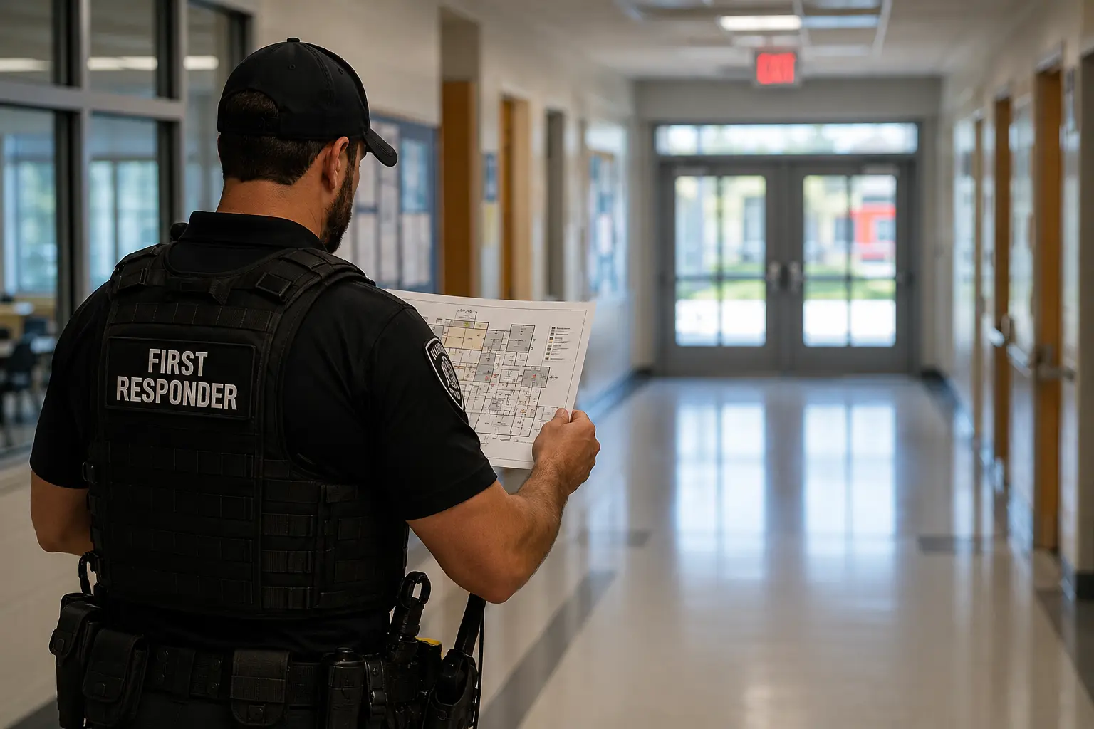
Federal school safety grants rarely name "mapping" as a standalone category. Instead, mapping qualifies as an eligible technology under broader objectives like emergency response coordination, physical security enhancements, and threat mitigation. Understanding how to position your mapping project within these frameworks determines whether your application moves forward.
School Safety Enhancement Program (U.S. Department of Education)
The U.S. Department of Education's School Safety Enhancement program makes $93 million available, with awards ranging from $500,000 to $5 million and an estimated 30 states expected to receive funds (U.S. Department of Education, 2026). The program prioritizes statewide systems that strengthen physical security, improve emergency operations, and support threat assessment teams. Indoor mapping fits when you frame it as infrastructure that enables faster response, better coordination with law enforcement, and more effective evacuation drills.
Eligible applicants include state educational agencies, which then distribute funds to local districts. The program does not fund standalone mapping software purchases. It funds integrated safety systems. Your proposal should explain how digital floor plans connect to your district's broader emergency operations plan, how first responders will access the maps during an incident, and how you'll train staff to keep the maps current.
Community Oriented Policing Services (COPS) School Violence Prevention Program
The COPS School Violence Prevention Program funds coordination between schools and law enforcement, including technology that improves situational awareness during emergencies. School safety mapping grants under this program must demonstrate how maps will be shared with local police, fire, and EMS agencies. The program values interoperability: can your mapping platform export data in formats that first responders already use?
Applications that succeed here emphasize partnerships. If your local police department has already requested digital floor plans, document that request. If your fire marshal has identified navigation challenges in your multi-building campus, include that assessment. The grant rewards projects that solve a documented coordination problem, not projects that introduce new technology without a clear operational need.
| Factor | What it is | Impact |
|---|---|---|
| Alignment to safety mandate | Mapping supports threat assessment or emergency ops | High |
| First responder access | Police and fire can view maps during incidents | High |
| Maintenance plan | Maps stay current after renovations and room changes | Medium |
| Interoperability | Exports to GIS, CAD, or dispatch systems | Medium |
| Training and adoption | Staff know how to update and use the maps | Medium |
How Do State School Safety Mapping Grants Work?
State-level school safety mapping grants are often more accessible than federal programs because they target mapping as a specific deliverable. Several states have passed legislation requiring or funding digital campus maps, and those mandates come with dedicated grant pools.
Minnesota's Digital GIS Mapping for School Facilities Grant Program
Minnesota made $7 million available for its Digital GIS Mapping for School Facilities Grant Program, anticipating up to 7 awards (Minnesota Department of Public Safety / ECN, 2025). The program funds GIS-based indoor maps that first responders can access through emergency response systems. Eligible applicants include school districts, charter schools, and nonpublic schools. The program explicitly requires that maps be delivered in formats compatible with public safety answering point software.
This is a model state program because it defines the deliverable clearly: indoor maps with room-level detail, utility shutoffs, and evacuation routes, delivered in a format that local 911 centers can ingest. If your state has similar legislation, your application should mirror that specificity. Describe the data layers you'll capture, the coordinate system you'll use, and how you'll validate accuracy.
Wisconsin's Act 109 Digital Mapping Grants
Wisconsin's Office of School Safety has awarded Act 109 digital mapping grants to 378 Wisconsin schools and school districts, totaling more than $6.2 million (Wisconsin Department of Justice, Office of School Safety, 2026). The program funds both initial mapping and ongoing updates. This is critical: most grant programs fund the first capture but leave districts without resources to update maps after renovations, room reassignments, or security upgrades.
Wisconsin's approach recognizes that a map frozen at the moment of capture loses value quickly. The average age of public school buildings in the United States is 42 years old (Campus Safety Magazine, citing NCES, 2024), and older buildings undergo frequent modifications. If your state offers multi-year funding or update grants, structure your proposal to include a refresh cycle.
What Can School Safety Mapping Grants Pay For?
School safety mapping grants fund more than software licenses. They can cover the full lifecycle of creating, deploying, and maintaining accurate indoor maps. Understanding the eligible cost categories helps you build a realistic budget and avoid the common mistake of under-scoping your project.
Data Capture and Processing
The first eligible cost is capturing the physical reality of your campus. This includes lidar scanning, photogrammetry, and point cloud processing. Some districts already have CAD drawings or architectural plans, but those documents are often outdated or lack the spatial accuracy first responders need. Grant funds can pay for professional capture teams to scan your buildings and generate georeferenced 3D models.
The alternative is partnering with a local university, GIS consultancy, or 3D capture firm that already owns the hardware. Some vendors offer turnkey services where they handle capture, processing, and delivery of the final maps. When budgeting, account for the number of buildings, total square footage, and complexity. A single-story elementary school costs less to map than a multi-building high school campus with underground tunnels and multiple entrances.
Software, Training, and Maintenance
After capture, you need a platform to host, update, and share the maps. School safety mapping grants can fund software subscriptions, cloud hosting, and integration with your existing emergency notification or access control systems. The key question is: who will maintain the maps? If your facilities team adds a new classroom wing or converts a storage room into a counseling office, someone must update the digital twin.
Training is an eligible cost that many districts overlook. Your grant budget should include time for facilities staff, school resource officers, and district safety coordinators to learn how to update maps, export data for first responders, and incorporate maps into lockdown drills. Without training, even the most accurate maps become shelf-ware.
Who Is Eligible to Apply for a School Safety Mapping Grant?
Eligibility varies by program, but most school safety mapping grants are open to public school districts, charter schools, and in some cases private or nonpublic schools. A few programs also allow applications from municipalities, law enforcement agencies, or regional educational service agencies that serve multiple districts.
Public School Districts and Charter Schools
Public school districts are the primary eligible applicants for both federal and state school safety mapping grants. Charter schools are eligible under most programs, but some states require charters to apply through their authorizing district or state educational agency. If you're a charter school, confirm whether you can apply directly or must partner with your district.
Some programs give priority to high-need districts, defined by factors like free and reduced lunch rates, prior incidents, or rural geography. If your district qualifies as high-need, highlight that status in your narrative. Grant reviewers are looking for projects that address documented risk, not theoretical concerns.
Private Schools, Faith-Based Schools, and Nonprofits
Private and faith-based schools are eligible under some state programs, particularly those funded through broader school safety or homeland security grants. Federal programs like the Nonprofit Security Grant Program (NSGP) can fund mapping for religious schools and other nonprofits at risk of targeted violence. The application process is more complex because you must demonstrate both eligibility and a credible threat profile.
If you're a private school applying for a school safety mapping grant, emphasize how your maps will be shared with local first responders. The grant is funding a public safety benefit, not a private asset. Your proposal should explain how police, fire, and EMS will access your maps during an emergency, and how you'll coordinate with the local 911 center.
See your building the way a first responder needs to.
Ark builds an operational digital twin of your facility from a single capture, so your team and responders can prepare, route, and defend every decision. Schedule a Demo.
How to Write a Competitive School Safety Mapping Grant Proposal
A competitive school safety mapping grant proposal answers three questions: What problem are you solving? How will mapping solve it? How will you measure success? Proposals that focus on technology features lose to proposals that focus on operational outcomes. Grant reviewers increasingly distinguish between static PDFs and interactive systems, a difference explored in critical incident mapping vs 2D floor plan comparisons that shape funding priorities.
Start with a Needs Assessment
Your proposal should open with a documented need. Have first responders requested digital floor plans? Has your district conducted a facility security assessment that identified navigation challenges? Have you experienced delays during lockdown drills because staff couldn't locate students in unfamiliar parts of the building? Quantify the problem. If your campus has 12 buildings across 40 acres and your local fire department has never trained inside your newest wing, state that.
The strongest needs assessments cite specific incidents or near-misses. The K-12 School Shooting Database recorded 349 school shooting incidents in 2023 (K-12 School Shooting Database via K-12 Dive, 2025), and school shootings wounded or killed a combined 269 people (K-12 School Shooting Database via K-12 Dive, 2025). But generic national statistics are less persuasive than local context. If your county has experienced a school threat, a hospital evacuation, or a multi-agency response that revealed coordination gaps, reference it.
Define Measurable Outcomes
Grant reviewers want to know what success looks like. Avoid vague promises. Instead of "improve emergency response," write "reduce first responder navigation time by providing room-level maps to dispatch within 60 seconds of a 911 call." Instead of "boost safety," write "complete annual lockdown drills in all 12 buildings using updated digital floor plans, with post-drill debriefs documented in our emergency operations plan."
Your outcomes should align with the grant program's objectives. If the program emphasizes coordination with law enforcement, your outcome might be "train 15 local police officers on campus map access and conduct a joint tabletop exercise within six months of map delivery." If the program emphasizes threat assessment, your outcome might be "integrate digital maps into our behavioral threat assessment team's site-visit protocol."
What Are the Common Pitfalls in School Safety Mapping Grant Applications?
Most school safety mapping grant applications fail for predictable reasons: vague scope, no maintenance plan, and weak alignment to the grant program's priorities. Understanding these pitfalls helps you avoid them.
Vague Technology Descriptions
Proposals that describe mapping technology in abstract terms raise red flags. Reviewers want specifics. What coordinate system will you use? Will your maps include exterior grounds, parking lots, and utility infrastructure, or only interior spaces? How will you handle multi-story buildings? Will your maps show locked doors, one-way corridors, and stairwell access?
One approach that addresses these questions is a living digital twin: a geospatially and contextually aware model of the building and its lifecycle, built from lidar and camera capture with proprietary point cloud processing, enriched with cloud meshes and integrated data layers. Ark Strategic, for example, provides exterior-twin RTK positioning that delivers the latitude and longitude of any place on the facility exterior, plus alphanumeric grid overlays and gridded facility maps delivered on request. This level of specificity shows reviewers you understand the technical requirements.
Avoid vendor-neutral language that could describe any product. Instead, explain what your chosen approach delivers: real-world coordinates, grid overlays for radio communication, or integration with your existing emergency notification system. The more concrete your description, the more credible your proposal.
No Plan for Ongoing Updates
A map that's accurate on delivery day but outdated six months later is a liability. Reviewers know this. Your proposal must explain how you'll keep maps current. Who on your staff will update the maps when you renovate a classroom, add a portable building, or change a room number? How often will you refresh the data? What triggers an update?
Some districts assign map maintenance to their GIS coordinator or facilities director. Others contract with the original mapping vendor for annual updates. Either approach works, but you must budget for it. If your grant doesn't fund ongoing maintenance, explain how you'll cover that cost after the grant period ends. A proposal that ignores this question signals to reviewers that your maps will become obsolete.
How Do Compliance and Interoperability Affect School Safety Mapping Grants?
Compliance requirements and interoperability standards determine whether your maps can be used by first responders. Many school safety mapping grants require that maps be delivered in formats accessible to public safety answering point software without requiring purchase of additional software or fees. West Virginia HB 3166, for example, requires school safety mapping data to be in formats accessible within public safety answering point software without requiring purchase of additional software or fees (West Virginia Legislature, HB 3166, 2025).
Data Format and First Responder Access
Your maps must be usable by the agencies that will respond to your campus. That means exporting data in formats like GeoJSON, KML, or shapefiles that GIS systems and computer-aided dispatch platforms can ingest. Some mapping platforms lock data in proprietary formats, forcing first responders to log into a separate system during an emergency. That's a non-starter.
Before you choose a mapping vendor, confirm that your local 911 center, police department, and fire department can access the data. Schedule a meeting with your county's emergency management director and ask what formats they prefer. If they use a specific GIS platform or dispatch system, make sure your maps are compatible. Grant reviewers often consult with local public safety agencies, and a letter of support from your fire chief or police chief strengthens your application.
Privacy, Data Retention, and Cybersecurity
School safety mapping grants come with data security obligations. Your maps show sensitive information: room layouts, security camera locations, utility shutoffs, and evacuation routes. If that data is compromised, it could be used to plan an attack. Your proposal must explain how you'll secure the data, who will have access, and how you'll comply with state and federal privacy laws.
Some states require that school safety data be stored on government-controlled servers. Others allow cloud hosting but require encryption and access controls. If your mapping platform stores data in the cloud, document the vendor's security certifications and data residency policies. If your state has specific cybersecurity requirements for school safety technology, cite them in your proposal.
The Bottom Line
School safety mapping grants fund the digital infrastructure that helps first responders work through your campus during a crisis. Federal programs like the School Safety Enhancement program and state initiatives like Minnesota's Digital GIS Mapping for School Facilities Grant Program provide millions of dollars for indoor maps, GIS data, and emergency response tools. The strongest applications frame mapping as part of a broader safety system, define measurable outcomes, and include a plan for keeping maps current.
Three factors determine success: aligning your project to a documented safety mandate, choosing technology that first responders can actually use, and building a maintenance plan that survives the grant period. As of 2026, 16 U.S. states have passed legislation requiring or funding school safety mapping programs (The Future 3D, 2026), and that number continues to grow. If your state has a mapping mandate or grant program, your district has a competitive advantage. If not, federal programs remain open to applicants who can demonstrate need and operational readiness.
The difference between a funded proposal and a rejected one often comes down to specificity. Vague promises about "improving safety" lose to concrete plans that name the buildings you'll map, the first responders you'll train, and the drills you'll conduct. Start with a needs assessment, define measurable outcomes, and budget for the full lifecycle of your mapping project. The grant is funding preparedness, not technology for its own sake.
Frequently Asked Questions
Is there a dedicated federal grant just for school safety mapping?
No single federal program funds only mapping. Instead, mapping qualifies as an eligible technology under broader school safety grants like the U.S. Department of Education's School Safety Enhancement program, which makes $93 million available to an estimated 30 states (U.S. Department of Education, 2026). Frame your mapping project as infrastructure that supports emergency response, threat assessment, or physical security.
What can a school safety mapping grant pay for?
School safety mapping grants can fund data capture, lidar scanning, software subscriptions, cloud hosting, training, and ongoing map updates. Eligible costs include professional capture services, GIS platforms, integration with emergency notification systems, and staff training. Budget for the full lifecycle, not just the initial purchase.
Which schools are eligible to apply for school safety mapping grants?
Public school districts and charter schools are eligible for most federal and state programs. Private and faith-based schools qualify under some state grants and the federal Nonprofit Security Grant Program. Eligibility varies by program, so confirm whether your school type can apply directly or must partner with a district or state agency.
How do I prove my district needs a school safety mapping grant?
Start with a documented need: first responder requests for digital floor plans, facility security assessments that identified navigation challenges, or delays during lockdown drills. Quantify the problem with specifics like the number of buildings, total square footage, or prior incidents. Local context is more persuasive than national statistics.
What happens if I don't have a plan to update the maps after the grant ends?
Reviewers will question your project's sustainability. Maps become outdated after renovations, room changes, or security upgrades. Your proposal must explain who will maintain the maps, how often you'll refresh the data, and how you'll fund updates after the grant period. Without a maintenance plan, your application is unlikely to be funded.
Contact Ark Strategic to discuss how a living digital twin can support your grant application and emergency preparedness goals.